


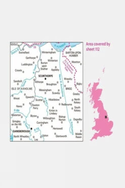
Active Landranger Map 112 Scunthorpe And Gainsborough
Original price was: £16.99.£11.89Current price is: £11.89.
- Excellent customer service online in a timely manner
- Enjoy top quality items for less
- Fast reliable delivery options
- Experience the Best Quality

Description
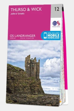
The Landranger Series of OS Maps is ideal for day trips and short breaks, offering 40 by 40 kilometers (25 by 25 miles) of easy-to-read, 1:50,000 scale coverage across Great Britain. Each map is overlaid with National Grid squares, allowing you to pinpoint any location with a unique reference. These maps provide detailed geographical information, showcasing places of interest, picnic spots, campsites, and tourist information. For England and Wales, Rights of Way details are included.
The Active version features a durable, weatherproof plastic coating while remaining easy to fold for convenient storage. Along with the physical map, you can download a digital version for iOS or Android devices via the OS Maps app using a unique code inside the map. Please note that revealing this code voids the option for return or exchange, though your statutory rights remain unaffected.
Technical details
Ideal use:
Walkers, climbers, mountain bikers, outdoor professionals
Materials:
Plastic-coated paper
Key features:
1:50,000 scale for detailed mapping
Weatherproof and tough design
Mobile download available
National Park information
Foldable for easy storage
National Grid squares for
Areas of interest
National Trails
Picnic spots
Campsites
Size and fit:
Folded dimensions: 240 x 135mm
| Brand | Ordnance Survey |
|---|---|
| Colour | No Colour |
| Product Code | S1254221 |
Be the first to review “Active Landranger Map 112 Scunthorpe And Gainsborough”
Related products


Belay & Descender Devices

Compasses


Equipment


Equipment
Reviews
There are no reviews yet.