


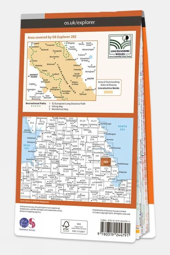
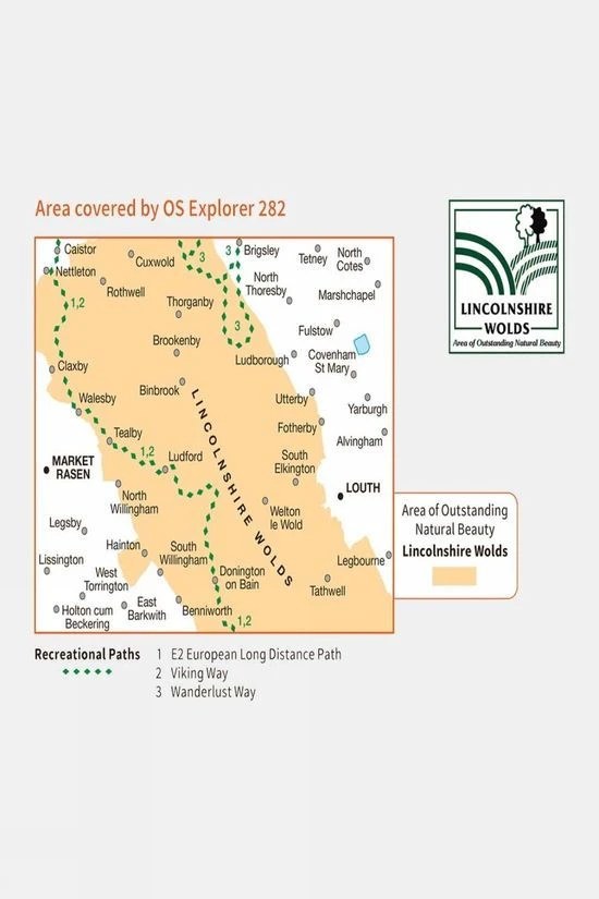


Active Explorer Map 282 Lincolnshire Wolds North
Original price was: £16.99.£11.89Current price is: £11.89.
- Excellent customer service online in a timely manner
- Enjoy top quality items for less
- Fast reliable delivery options
- Experience the Best Quality

Description
Ordnance Survey’s Explorer Maps are the go-to choice for outdoor enthusiasts, including walkers, climbers, mountain bikers, and professionals who need precise navigation. Featuring a 1:25,000 scale, these maps provide detailed information, with National Grid squares giving each part of Great Britain a unique reference. You’ll find a wealth of features like points of interest, picnic spots, campsites, National Trails, and Rights of Way information for England and Wales.
The Active version is weatherproof and durable, thanks to its plastic coating, while still folding easily for convenient storage. Upon purchasing, you can download the digital version to your iOS or Android device via the OS Maps app using a unique code inside the cover. Note, once the code is revealed, refunds or exchanges are not accepted, ensuring your rights remain protected.
Technical details
Ideal use:
Walkers, climbers, mountain bikers, outdoor professionals
Materials:
Plastic-coated paper
Key features:
1:25,000 scale for detailed mapping
Weatherproof and tough design
Mobile download available
National Park information
Foldable for easy storage
National Grid squares for
Areas of interest
National Trails
Picnic spots
Campsites
Size and fit:
Folded dimensions: 240 x 135mm
| Brand | Ordnance Survey |
|---|---|
| Colour | No Colour |
| Product Code | S1244603 |
Be the first to review “Active Explorer Map 282 Lincolnshire Wolds North”
Related products

Equipment


Equipment


Day Hiking Packs
Reviews
There are no reviews yet.