


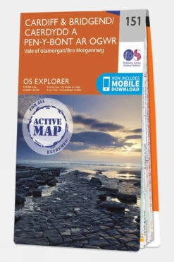


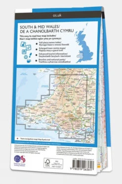
Active Explorer Map 151 Cardiff And Bridgend
Original price was: £16.99.£11.89Current price is: £11.89.
- Excellent customer service online in a timely manner
- Enjoy top quality items for less
- Fast reliable delivery options
- Experience the Best Quality

Description
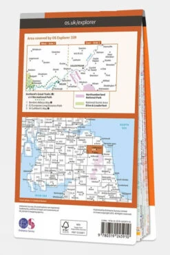
Discover the Explorer Series OS Map, the ultimate tool for navigating the great outdoors with confidence. Known for its exceptional detail and precision, this map is a must-have for walkers, climbers, mountain bikers, and outdoor enthusiasts alike. Whether you’re exploring new trails or revisiting familiar ones, the 1:25,000 scale ensures a clear and comprehensive view of the terrain, mapping the surrounding Welsh areas of Cardiff and Bridgend. Each map is designed to provide essential information at a glance, including National Grid reference squares that offer pinpoint accuracy across Great Britain.
Packed with features like points of interest, picnic spots, campsites, and National Trails, the Explorer Series also highlights National Parks and Rights of Way for England and Wales, making it easy to plan your next adventure. Ideal for professionals and hobbyists, this map guarantees you’ll never lose your way; whether you’re tackling rugged landscapes or enjoying a leisurely countryside walk. This Active version has a plastic coating across the paper, making it tough and weatherproof. It still folds easily so that it can be stowed in your pocket or rucksack. Get your Explorer Series OS Map today, and experience outdoor navigation like never before!
Technical details
Ideal use:
Walkers, climbers, mountain bikers, outdoor professionals
Materials:
Plastic-coated paper
Key features:
1:25,000 scale for detailed mapping
Weatherproof and tough design
Mobile download available
National Park information
Foldable for easy storage
Areas of interest
National Trails
Picnic spots
Campsites
Size and fit:
Folded dimensions: 240 x 135mm
| Brand | Ordnance Survey |
|---|---|
| Colour | No Colour |
| Product Code | S1244462 |
Be the first to review “Active Explorer Map 151 Cardiff And Bridgend”
Related products


Equipment

Equipment


Belay & Descender Devices
Day Hiking Packs

Equipment
Reviews
There are no reviews yet.